News & Events

Crop Corner – Data
July 01, 2016
As the combines start rolling into wheat harvest, it is time to start collecting yield data. If you have never taken the time to set up your yield monitor – today is the day! Precision agriculture and variable rate technologies are increasing in popularity and improving in efficacy. If you are interested in using these technologies in the future, whether it be next year or 10 years from now, it is important to begin the process now by collecting good data. If your combine is equipped with a yield monitor, take the time to input each field name as you enter the field and calibrate the monitor before switching varieties or at minimum before switching crops. Yield data can be used to identify consistently good or consistently poor areas of a farm, the more years’ worth of data you have, the more accurately you can determine areas of the field that perform differently from one another. These areas are often defined as management zones, which can then be managed differently in terms of nutrient or lime application, seeding rate, pesticide application and much more.
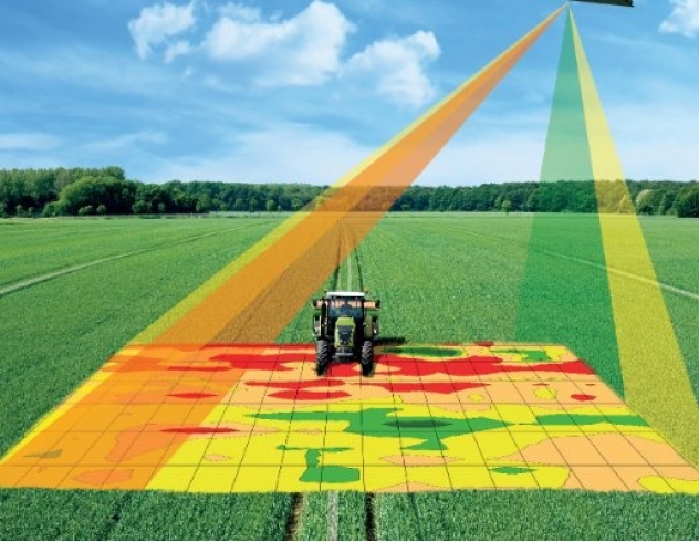
If you do not have a yield monitor, there are several other ways to collect field data. Bare ground imagery will often indicate changes in soil type, moisture, and topography. This can be collected through either satellite imagery or by drone. Drones can also be used to fly over crops in season to gain Normalized Difference Vegetation Index (NDVI) readings for a field. NDVI values are essentially a measure of light reflectance from green tissue. An NDVI map of a field will reflect areas or high vegetation and low vegetation; these differences often correlate to yield at the end of the season. NDVI maps are a useful tool for in season crop management. For example, an NDVI map of a corn field flown at canopy closure can be used to create a variable rate nitrogen application map so that better areas of the field receive more nitrogen and poorer areas of the field receive less.
The goal of variable rate technology is to apply inputs in a way that leads to the greatest return on investment. The team at Clark Agri Service encourages you to begin collecting field data this season and are happy to help you overlay different layers of data and create management zones using our data management software. From there, we can help conduct zone sampling and prescription maps for various inputs and variable rate apply fertilizer with our equipment. Please speak with your sales agronomist if you would like to learn more or are interested in having any fields flown with a drone to receive NDVI or aerial imagery maps!
This Crop Corner has been written by Michelle Baker, Sales Agronomist at Clark Agri Service. Michelle can be reached by email mbaker@clarkagriservice.com or by phone 289-244-3888